Watershed
Asagro Services
Get a higher yield with Asagro analytics solutions
Satellite Data Acquisition
Modeling and Simulation
Analysis and Evaluation
Considering the emerging nature of this industry worldwide and the high potential for its implementation, ASAgro is striving to provide monitoring services in Watersheds by utilizing its specialized knowledge in the satellites and agricultural analysis. In this regard, aerial and satellite imaging, along with the analysis of the resulting maps, can be used to monitor and investigate lands in the shortest possible time.
Best time to conduct analysis in Watershed
The best time to conduct an analysis in a watershed can vary depending on the specific objectives and factors involved. However, it is generally recommended to conduct watershed analysis during periods of stable hydrological conditions. This typically occurs during the dry season or when there is minimal rainfall and runoff. Conducting analysis during these periods allows for more accurate assessments of water availability, flow patterns, and other hydrological parameters. Additionally, it is important to consider any specific seasonal variations or events that may impact the watershed, such as snowmelt or monsoon seasons, and incorporate them into the analysis as necessary.
Providable Services in Watersheds
Observing the overall status of the area
1) Assessing the overall status of the area using high-resolution aerial images and maps
2) Ability to create maps with customizable resolutions ranging from 1 to 10 centimeters 3)
Accurate and visual determination of the positions of objects, structures, areas, plants 4) etc,
Capability to provide results in all standard formats
اینجا کلیک کنید
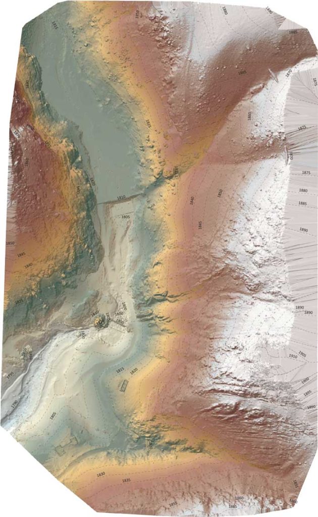
Identification of water channels, modeling, and simulation of water flow
1) Preparation of high-precision elevation and topographic maps of water channels 2)
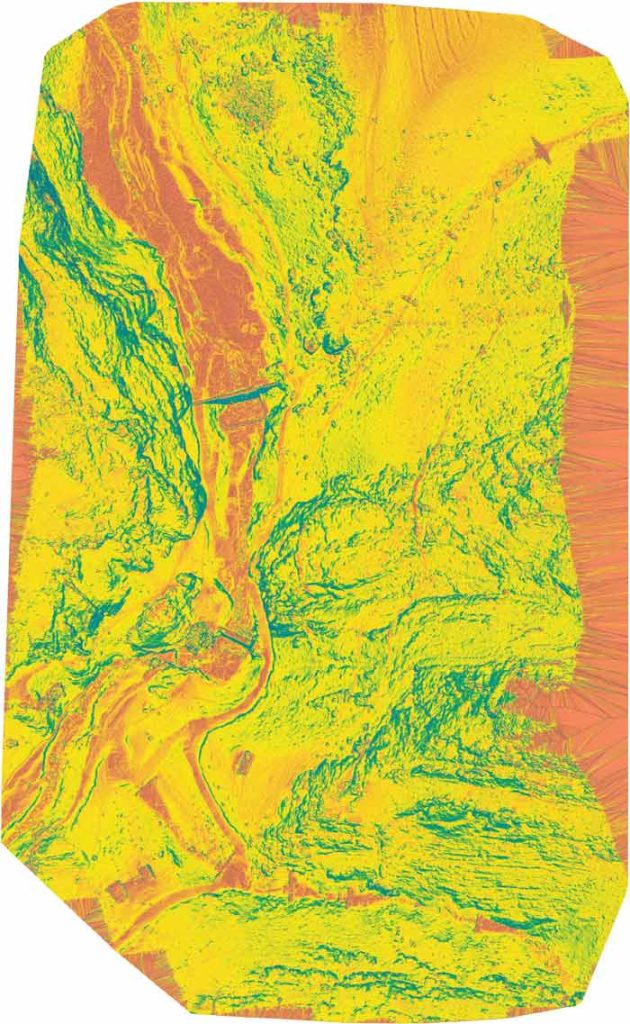
Preparation of maps indicating the magnitude and direction of land slope 3)
Modeling and simulation of water flow in water channels 4)
Analysis of water flow velocity in water channels
اینجا کلیک کنید
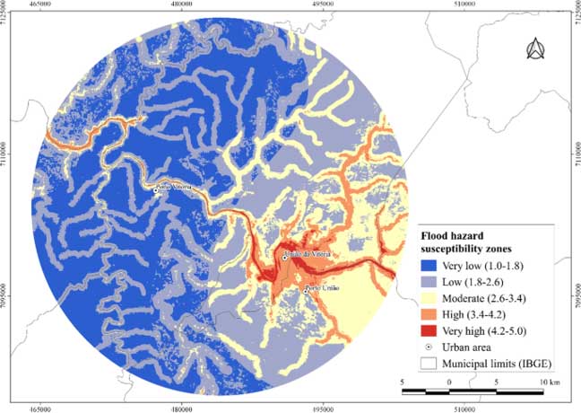
Preparing a flood probability map
1) Preparation of flood probability map 2)
Overlaying sensitive areas (such as cities, roads, etc.) on the map 3)
Ability to incorporate various inputs for integration
اینجا کلیک کنید
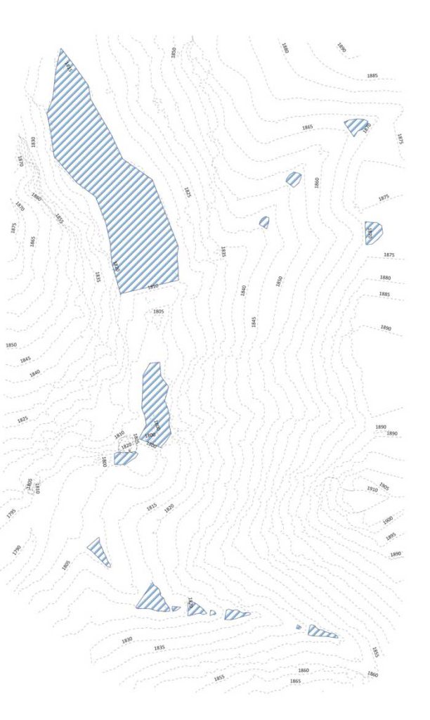
Monitoring the performance of watershed structures
1) Geographical location of the structure 2)
Area of sediment deposition on the surface 3)
Elevation and volume of empty space within the structure. Type of structure 4)
Structural geometry (height and width) 5)
Three-dimensional model of the structure 6)
Area of vegetation cover on the structure
اینجا کلیک کنید
The analyses conducted by ASAgro on Watershed


مقالات مرتبط با رشد گندم
- آیتم #1 در لیست
- آیتم #2 در لیست
- آیتم #3 در لیست
What Our Clients Say About Us
I had a very positive experience using ASAgro's services in precision agriculture. This company helped me manage different parts of my farm more accurately and economically. By utilizing their advanced technology and powerful software, I was able to focus only on the areas that needed attention and make necessary changes. I am very satisfied with the results and I highly recommend ASAgro to all fellow farmers.
Ali AsadiFarmer
I had a very different experience using ASAgro's services in precision agriculture. They helped me manage my resources more accurately and intelligently. By utilizing advanced technology and innovative methods, I was able to minimize costs and improve the performance of my products. I was completely satisfied and I highly recommend these services to all other farmers.
Hossein MohammadiFarmer
Previous
Next
Contact Us
info@asauas.com
- Sharjah Media City, Sharjah, UAE
- (+971) 504 766 075

